THE MARITIME ATLASThe Tunnels of Halifax

A LEGEND AND A RECORD · 1749 TO TODAY

The Tunnels of Halifax

For generations people have said a tunnel runs from the Citadel to Georges Island.
Here is what has been found under the downtown streets, and what it was.

01 · THE FILM · 82 SECONDS, NARRATEDTHE CITADEL TO GEORGES ISLAND

Is there really a tunnel
under Halifax Harbour?

The film starts with the legend and checks it against the record: the finds under the downtown streets, the city engineer's sewer report of 1866, the Citadel's own tunnels, the tunnels under Georges Island, and the 2013 survey of the harbour floor.

Every map, date and name in it comes from this page. It is drawn from the same map as the live map below.

Map, research, script and animation by Joel Hirtle. Narration: a computer voice (Microsoft neural text-to-speech) reading Joel's script. Archive photographs: Royal Engineers, Nova Scotia Archives; John Kelly's 1866 report from the Internet Archive. The subtitles are part of the picture.

The film opens on Instagram in a new tab. Nothing loads from Instagram until you choose to watch it.

Watch on Instagram ↗

↑ BACK TO TOP

02THE LIVE MAP

What is under
the downtown streets.

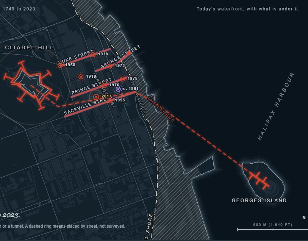
Run the clock from 1749 to 2023. The map draws the original shore and the land filled since, the Citadel's gallery, the sewers of 1866, the tunnels under Georges Island and every find under the streets, each in its year, with its source.

The live map loads about 1.7 MB and draws in your browser. The film above is made from the same map.

↑ BACK TO TOP

03THE LEGEND

A tunnel to the island,
1.81 km under the harbour.

The story says a tunnel runs from the Citadel down under the harbour to Georges Island. In a straight line that is 1.81 km (1.12 miles), measured between the province's official name points for the two.

It is an old story, and it has been answered for as long as it has been told. Harry Piers's history of the Halifax fortress, printed in 1947, seven years after his death, says there is no passage for men from the Citadel to the harbour or to the island. In 1973 the Mail-Star called the legend a persistent fairy tale. In 2013 Parks Canada said a survey of the harbour floor showed no evidence of a tunnel, and in 2023 the Geological Survey of Canada listed it among the myths of Halifax Harbour.

What Piers did find under the Citadel's glacis was a large, carefully built brick sewer that a man could pass through by stooping.

Halifax Public Libraries (the Mail-Star, 1973); Piers (1947), p. 42 note 6; Parks Canada's Hal Thompson to CTV Atlantic (2013); the Geological Survey of Canada, Open File 8945 (2023). The distance: GeoNAMES points for the Citadel and Georges Island.
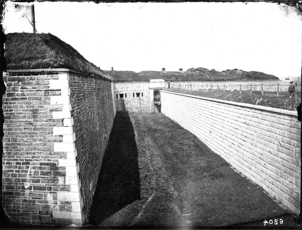
The Citadel in 1870: a stone gate in the redan, the ditch below it.
The Citadel (Fort George), the redan and gate over the ditch, 1870. Royal Engineers photograph, Nova Scotia Archives, NSA no. 6804.

↑ BACK TO TOP

04THE FINDS

What turns up
under the streets.

Halifax Public Libraries keeps a list of underground finds downtown. It runs from 1919 to 1995, and most of it gives a year and a street, not a place.

The two best told are close together. In 1973 the road at the bottom of George Street caved in over a tunnel; a city inspector followed it as far as Hollis Street, and reporter Barbara Hinds went in. In 1976 a Nova Scotia Power crew replacing a pole on Prince Street broke into a passage.

Under the Halifax Club on Hollis Street a trapdoor opens on a passage about 50 ft (15 m) long, believed built with the building around 1861. In 2015 archaeologist Laura de Boer and Halifax Water sent a camera rover under Duke Street and found no older construction. In June 2017 a hole on Argyle Street went viral as a tunnel: it was a brick manhole over a 24-inch (61 cm) clay sewer pipe.

Halifax Public Libraries, "The Tunnels of Halifax – Fact and Fiction" (2022); CBC News (2017). The Duke Street camera rests on the library's account alone.

The finds on the library's list, with the two it tells in full
YearStreetFound
1919George StreetA tunnel, on the list
1938Duke StreetA tunnel, on the list
1958Brunswick StreetA tunnel, on the list
1973George StreetThe road caved in; walked as far as Hollis Street
1976Prince StreetA passage, broken into by a power crew
1978Bedford RowA tunnel, on the list
1995Sackville StreetA tunnel, on the list

↑ BACK TO TOP

05THE SEWERS OF 1866

The city engineer's report,
7 February 1866.

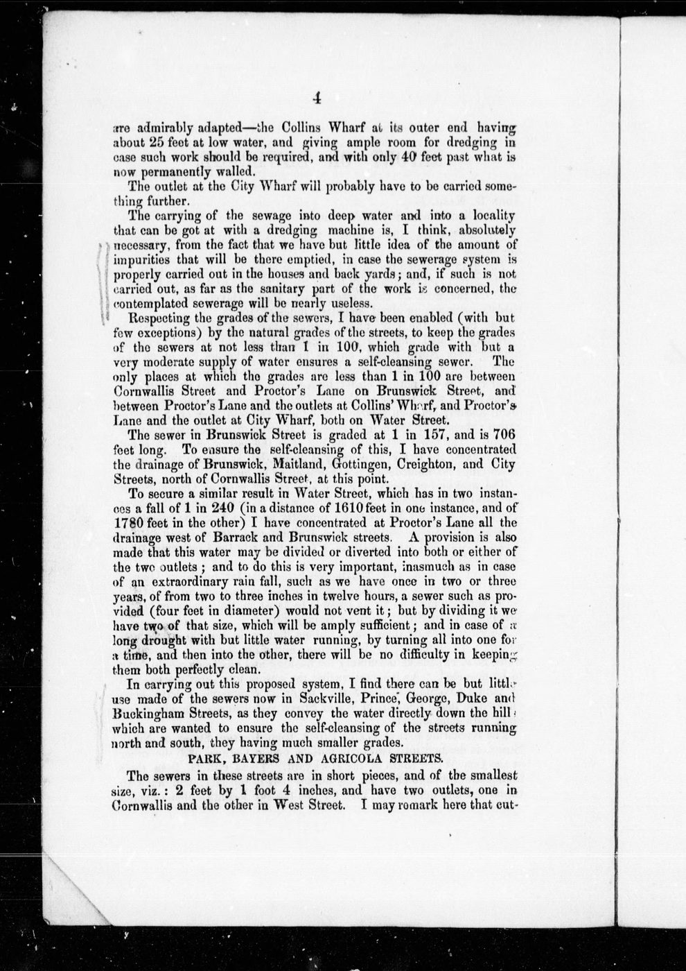
On 7 February 1866 the city engineer, John Kelly, reported to City Council on the sewers. Those in Sackville, Prince, George, Duke and Buckingham streets, he wrote, carry the water directly down the hill. They are the streets the finds keep turning up on.

Some were in bad shape. On Prince Street, from Bedford Row to the Water Street outlet, the side walls were gone for some distance, and nothing but the arch was holding up the street.

The library's own account comes to the same place. Archaeologist Laura de Boer says the larger tunnels under the downtown streets are what remains of the old sewer system; when a walled-off section was opened it held 19th- and 20th-century pipes.

John Kelly, Report on Halifax Sewerage (1866), Internet Archive, CIHM 63443; Halifax Public Libraries (2022). The streets match by name: no survey has traced each find to a sewer.

A printed page of John Kelly's 1866 report on the Halifax sewers.
A page of John Kelly's Report on Halifax Sewerage, 1866. Internet Archive, CIHM 63443, public domain.

↑ BACK TO TOP

06THE REAL TUNNELS

Under the Citadel
and under Georges Island.

Halifax does have military tunnels. Inside the Citadel's counterscarp wall, the outer wall of the ditch, runs a vaulted gallery about 3,500 ft (1,070 m) long, begun in 1829 to 1832 and completed in 1838 to 1849. From it, T-shaped countermines run out under the glacis, where charges could be fired under an attacker standing above. The gallery's loopholes covered the ditch.

Fifteen of the countermines have collapsed or partly collapsed, and one engineer cut half of the planned countermines in the 1830s. Both points rest on one source, the federal heritage statement for the gallery.

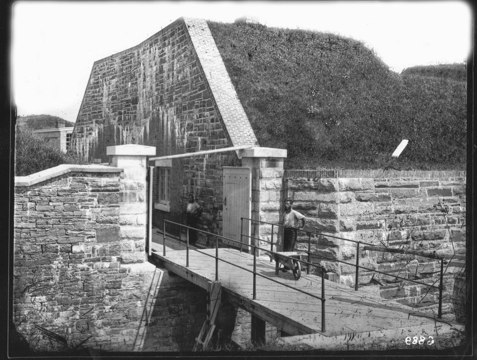
On Georges Island, Fort Charlotte's main magazine and tunnel complex was built from 1865 to 1867: a maze of brick ammunition tunnels under the centre of the island. Parks Canada runs guided tours of them while the island is open, from June to October.

And the hatch on Citadel Hill opens on an 83 m (272 ft) Parks Canada utility tunnel, not a secret passage (CBC News, 2016; one source).

Parks Canada, Federal Heritage Buildings Review Office, statement 95-01 (1995); Canada's Historic Places, Main Magazine and Tunnel Complex; Parks Canada, Georges Island tunnel tours.

The Citadel's ditch about 1879, with the loopholes of the musketry gallery in the counterscarp wall.
The Citadel's ditch about 1879; the loopholes in the counterscarp wall are the gallery's. Royal Engineers photograph, Nova Scotia Archives, NSA no. 6818.
Fort Charlotte on Georges Island about 1876: the gate and drawbridge over the ditch.
Fort Charlotte, Georges Island: the gate and drawbridge, about 1876. Royal Engineers photograph, Nova Scotia Archives, NSA no. 6889.

↑ BACK TO TOP

07THE SHORE THAT MOVED

The waterfront
is not where it was.

When Halifax was founded in 1749, today's waterfront property was part of the harbour. The shore ran about where Water Street runs now, and Water Street began as a path along the beach.

In 1759 the governor's council let a wharf or breastwork be built out from the shore, 169 ft (52 m) along it. Wharves went out, and the water between them was filled. As late as 1803 part of one waterfront site was still open water; its owners filled it within a few years. At the south end the Ocean Terminals were built from 1912 to 1928, partly on rock from the new railway cut.

On the live map, a beige dash-dot line marks the original shore and a hatch marks the land filled since: about 76 ha (188 acres) on the Halifax side. The line is an estimate, good to about 50 m along the harbour, from Des Barres's chart of 1779 and Harris's plan of 1749 fitted to today's map.

Tom Tulloch, Halifax Military Heritage Preservation Society (2019); Susan Buggey, Halifax Waterfront Buildings, Parks Canada (the 1759 wharf and the 1803 site rest on her report alone); Canadian Society for Civil Engineering, Ocean Terminals. The method is on the data page.

THE WATERFRONT, BY THE RECORD

1749The shore about where Water Street runs
1759The first wharf or breastwork, 169 ft (52 m)
1803Part of one waterfront site still open water
1912 to 1928The Ocean Terminals, partly on landfill
TodayAbout 76 ha (188 acres) of filled land on this map

↑ BACK TO TOP

08WHAT IS NOT KNOWN

Where the record
runs out.

↑ BACK TO TOP

09READING THIS PAGE

From the record,
with the gaps marked.

The story comes from the library's account of the tunnels, the city engineer's 1866 report, Piers's history of the fortress, Parks Canada's heritage statements, the Geological Survey of Canada and CBC News. Every moment on the live map carries its sources. A solid dot means two sources or a primary record; a hollow one, one source.

Tunnel plans on the map are drawn to show the idea, not surveyed. The legend's route is dashed because no one has found it.

Places: the finds are placed on their streets, not at surveyed spots, and drawn with a dashed ring. The shore and streets are today's; the original shore is an estimate from two old maps, drawn over them.

Read the data method ↗

↑ BACK TO TOP