A rumour of a letter from London turned Lunenburg's settlers against their officials. Halifax sent two hundred soldiers.
01 · THE FILM · THREE MINUTES, NARRATEDFROM THE RHINE TO GEORGE'S ISLAND
Three minutes, from the Rhine to George's Island.
The film follows the families down the Rhine to the ships in 1750, across the Atlantic to Halifax, and on to Lunenburg in June 1753. Then it follows the rising of December 1753 through the town's streets, and John William Hoffman to his trial.
Every map, date and name in it comes from the record on this page. It is drawn from the same map as the live map below.
Map, research, script and animation by Joel Hirtle. Narration: a computer voice (Microsoft neural text-to-speech) reading Joel's script. Sound effects from freesound.org, credited at the foot of the page. The subtitles are part of the picture.
The film plays in YouTube's privacy-enhanced mode. Nothing loads from YouTube until you press play.
Play the days yourself. Move the clock, read every recorded moment with its source, and hover the places on the plan of the town as it stands today.
The live map loads about 3 MB and draws in your browser, so it runs best on a fast computer. The film above is made from it.
THE DAY
0of 24 recorded moments
—before nine in the morning
75-second clock
Reduced motion is on: the map shows the last day. Play still runs the clock if you press it.
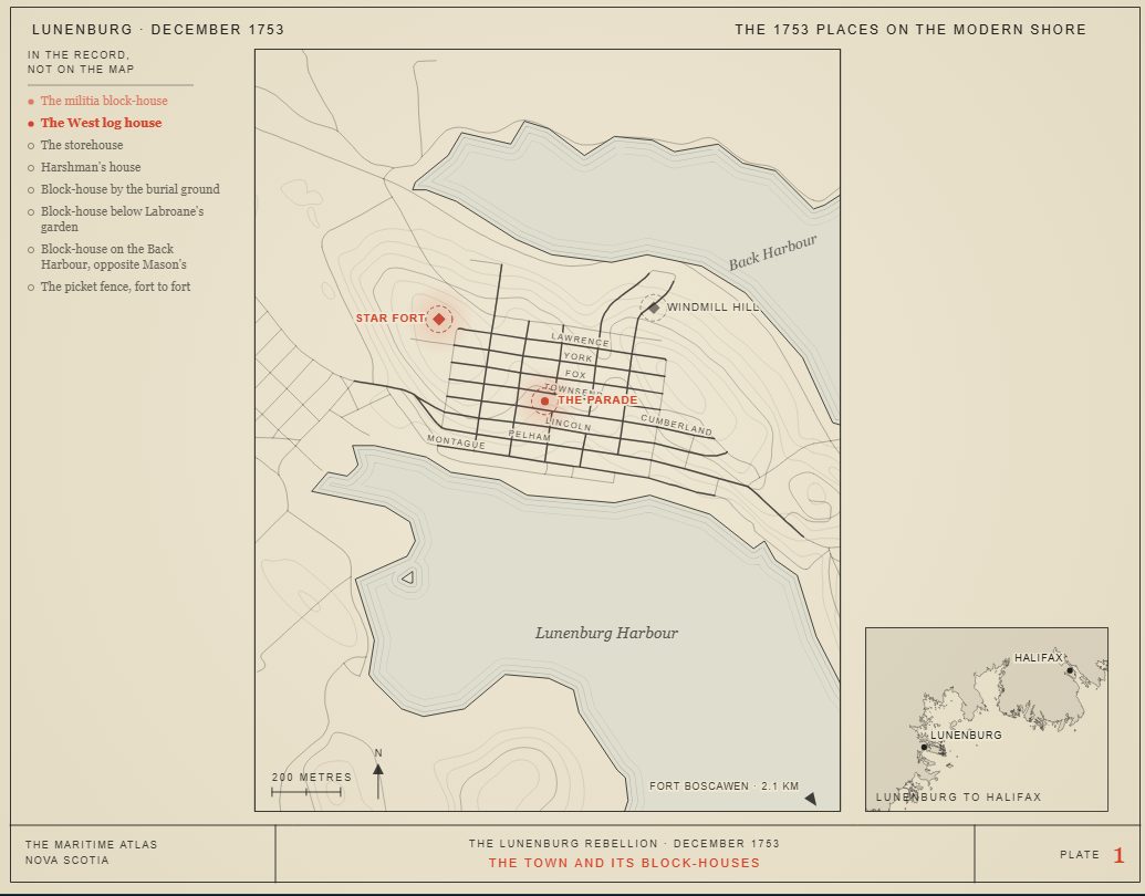
Lunenburg · December 1753The 1753 places on the modern shore
Charting the town…
15 December 1753 to 14 January 1754. Hover a place. A dashed ring means the position is approximate.
The settlers The soldiers and the government · one figure = 20 men Block-house or fort Approximate positionToday's shoreline, streets and contours, not the ground of 1753. Not for navigation.
On Saturday 15 December 1753 a report ran through Lunenburg. A letter from London, people said, told how Parliament had ordered food, rum, clothing, tools and five pounds in cash for every settler. The settlers went looking for the man said to have it, Jean Pettrequin, and locked him in the militia block-house.
It found ready listeners. The 1,453 foreign Protestants had landed at Lunenburg on 7 June. Supplies were short, and from their arrival many felt cheated of what the government had promised them.
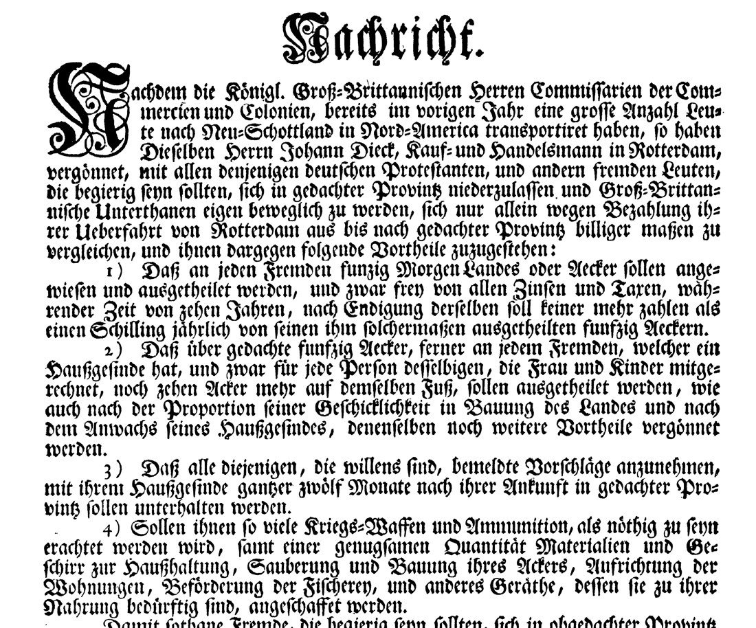
What it had promised was printed in German in 1750: fifty acres each, free of rent and taxes for ten years, ten more acres for each member of a family, their keep for twelve months after they arrived, and arms and ammunition. A free passage was not on the list. The settlers who came from Britain in 1749 sailed at the Crown's cost; these families had to pay their own fares, and worked them off on the public works at Halifax.
The letter itself was never found.
WHAT THE LETTER WAS SAID TO PROMISE
Bread · meat · pease · rice · hulled oats
Molasses · a pint of rum
Stockings · shoes · shirts · clothing
Household utensils · farm implements
Five pounds in cash, to each person
From the town's own memo of December 1753, as printed by DesBrisay in 1895 (pp. 32–33).
“Nachricht”, the 1750 notice that called for settlers: the land, the year's keep, the arms. SUB Göttingen, Digitalisierungszentrum (GDZ), collection Nordamericana.
A carpenter from Montbéliard, born about 1724. He came to Nova Scotia in July 1752 aboard the Betty. The crowd locked him up on 15 December because he was said to have the letter. Under torture he named the magistrate; later, questioned by Monckton, he named Hoffman. He was buried at Lunenburg on 19 December 1764.
Sent to Lunenburg as a magistrate in 1753. When Pettrequin said the magistrate had the letter, the crowd threatened to pull him limb from limb, and he took refuge in the Star Fort on Gallows Hill. The next morning they came to the gate and demanded him, dead or alive.
The officer commanding at Lunenburg. He freed Pettrequin once, had the Riot Act read, sent constables with a warrant, and talked to the crowd for nearly an hour. On the night of the shots he sent Lieutenant Adams to Halifax with a letter.
President of the Council, governing the colony. Adams reached Halifax on the evening of 17 December, and on 18 December Lawrence called the Council to his house. It sent two hundred soldiers to disarm the town. He wanted the ringleaders punished.
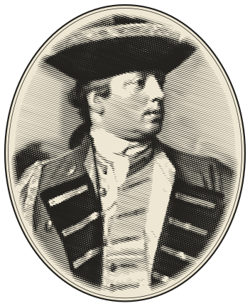
Lieutenant-colonel of the 47th Foot. He volunteered to lead the two hundred, landed on 22 December, and disarmed the town in two or three days without a fight. He told Halifax the settlers had mostly acted together, and advised a general pardon.
A former justice of the peace. On 28 December Pettrequin said Hoffman had shown him a letter on the parade and said a sailor had given it to him. Soldiers arrested Hoffman at Harshman's house on 31 December. Tried in Halifax in 1754, he was fined £100 and imprisoned for two years on George's Island.
A town behind pickets, with block-houses round it.
Lunenburg was laid out in 1753 behind a picket fence that ran from the front harbour to the back, with block-houses for its defence. A memo of that year lists them, and DesBrisay printed it in 1895.
Two block-houses in the story are on no list: the militia block-house, where Pettrequin was held and the settlers kept their arms, and the guard house they fired on, which Murdoch calls the West log house and the Dictionary of Canadian Biography the lower block-house. No source says where either stood, so the map does not draw them.
The list also names a block-house at Jacob Hirtle's mills, outside the town. Where the mills were is not recorded.
The memo of block-houses, 1753 (DesBrisay, p. 31)
Block-house
On the map
Garrison block-house on Gallows Hill, the Star Fort
Approximate: the Lunenburg Academy's hill
Block-house on Windmill Hill, later Block-house Hill
Approximate: the official name point
Fort Boscawen, Battery Point. It cost £219 11s. 3d.
Approximate: the official name point
By the burial ground
Not located
Below Labroane's garden, on the back of the shore
Not located
On the Back Harbour, opposite Mason's
Not located
The picket line, front harbour to back
Approximate: the plan of c. 1753
Outside the town: Mush-a-Mush, Morriott Brook, North-West Range, Lower and Upper La Have, Jacob Hirtle's mills
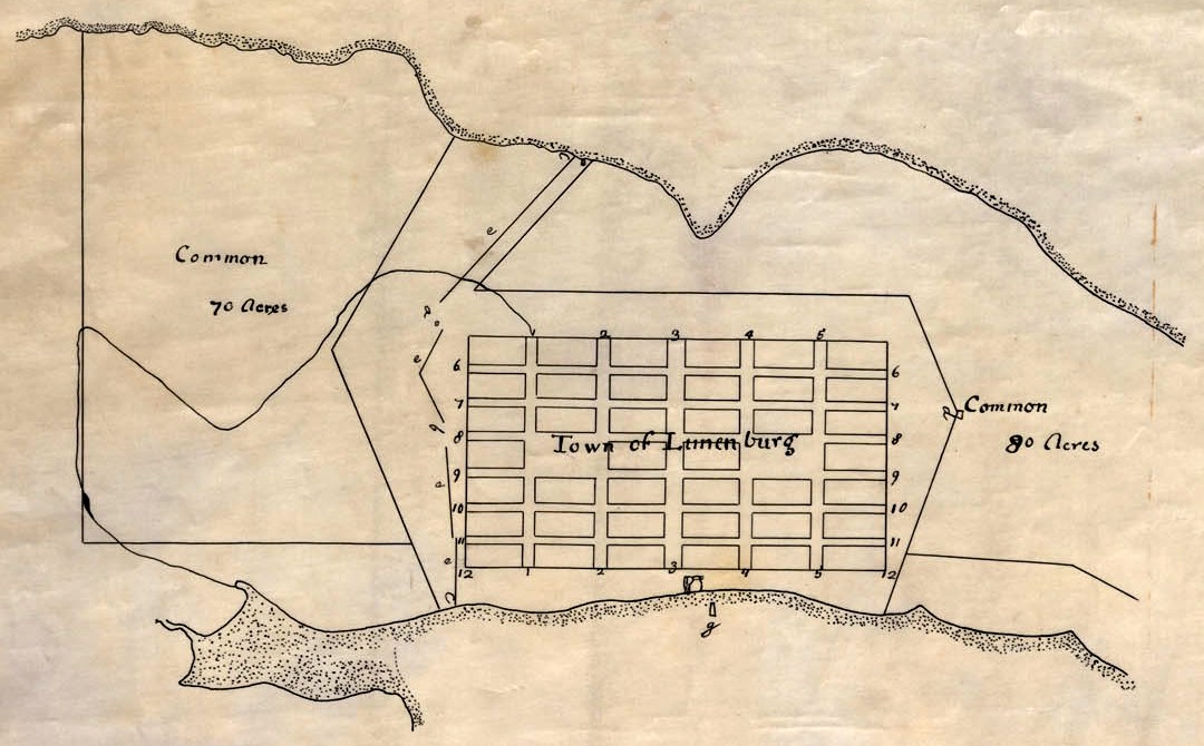
Six divisions of eight blocks, and lots drawn by playing cards.
The town plot, approved by Governor Hopson, was six divisions of eight blocks, each block fourteen lots of 60 by 40 feet (18 by 12 m). The divisions were named for their officers: Zouberbuhler's, Creighton's, Morreau's, Rudolf's, Straesburgher's and Steinfort's.
The lots were drawn before the settlers left Halifax, and they were drawn with playing cards. Some of the cards were later produced in court as evidence of title.
DesBrisay (1895), p. 43; Dictionary of Canadian Biography, Sutherland. The card DesBrisay saw in court was said to be from a later drawing, of 1767.
A plan of the Town of Lunenburg, c. 1753. Nova Scotia Archives, V7/239.
Where the accounts differ, and which one the page follows.
Torture. Murdoch and the Dictionary of Canadian Biography say Pettrequin was tortured. The town's own memo of 1753 says he was bound hand and foot, and threatened. The page follows the two that agree, and says so.
The guard house. Murdoch calls it the West log house; the Dictionary of Canadian Biography, the lower block-house.
The French. Wikipedia's article on Father Le Loutre's War ties the rising to Le Loutre and speaks of a "republic" and an army captain. Murdoch, working from the council minutes, wrote: There was no proof, however, that the French had instigated them. The page follows Murdoch.
The fine. £100 in the Dictionary of Canadian Biography, Akins and Cahill. Murdoch printed a blank for the amount. Akins gives the sentence as £100 or two years; the others, a fine and two years.
The charge. Seditious conspiracy (Cahill); "high crimes and misdemeanors" (Murdoch); a false and scandalous libel and inciting a riot (Dictionary of Canadian Biography).
Why the treason bill failed. Only one witness to the main fact (Murdoch); a grand jury's protest over state policy and corruption (Cahill, as summarised in Boudreau's review). The two reasons do not rule each other out.
After prison. Banishment from the colony is Cahill's alone, so it is marked one source.
The plot of 1753 is still the street grid of Old Town Lunenburg, a National Historic Site since 1991 and a UNESCO World Heritage Site.
The Star Fort's hill is the Lunenburg Academy's. A survey there found traces that may be a palisade; the fort's outline is not proven, so the map marks the place, not the fort.
“We may fairly conclude that they had just causes of complaint, although their conduct may have been rash.”
The story is the town's own memo of December 1753, Beamish Murdoch's history of 1866, which he wrote from the council minutes and Lawrence's letters, and the Dictionary of Canadian Biography. Every moment on the live map carries its sources. A solid dot means two independent accounts agree; a hollow one, one source.
Times are given only where a source prints them. Otherwise the record shows the part of the day the source names.
Places are marked only where a source names them. Most are approximate and drawn with a dashed ring; places no source locates are listed, not drawn. The four vessels' track and the landing place are not recorded: the map draws them to show the arrival and says so. The shoreline and streets are today's, not the ground of 1753.